Google provides two options for using map services:
- Google Maps, based on the JavaScript API, which is dynamic and provides lots of options to display various geographic information.
- Maps Static API, that provides much less functionality, but sometimes it’s the only one kind of map which could be used.
Both types of services have their advantages and can be used in different application areas.
What is Maps Static API?
Maps Static API is a regular bitmap. This map has no interactive user interface.
“The Maps Static API lets you embed a Google Maps image on your web page without requiring JavaScript or any dynamic page loading. This service creates your map based on URL parameters sent through a standard HTTP request and returns the map as an image you can display on your web page.”
In general terms, using this service, you can simply display a specific image of map, with the maximum size of the map image is 640*640 pixels. You can specify coordinates and additional marks.
Before to start Using the Google Maps Platform, you need to register and get the API key, that is necessary in most cases. Moreover, developers are provided with full information about the Maps Static API.
To enable the feature and Show map as a Static image, move to the Map Properties Tab and click the checkbox:
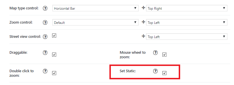
This will allow you to make the usage of Google Map on the website much cheaper according to new Google Maps API usage Rates. Also, if you have no possibility to use dynamic maps in a project, due to the non presence of JavaScript support on the target platform, Maps Static API is the best solution.
Map static
